Founded in 1992, MapmyIndia is IndiaÍs leader in premium quality digital map data and APIs, GPS navigation, tracking, location apps and GIS solutions.
Head quartered in New Delhi with offices across India, MapmyIndia is an ISO 9001-2012 company with 750+ people that pioneered digital mapping in India. Since 1995, through continuous field surveys and state-of-the-art mapping technology, MapmyIndia has built its proprietary MapmyIndia Maps, the most comprehensive, accurate, reliable, full-featured, professionally created and continuously updated digital map dataset for all India, including its revolutionary RealView service which captures, analyses and publishes the world in 3D and 360-degree photo-realistic clarity, all of which are used for a wide range of Navigation, Telematics, ADAS, GIS, LBS and Smart City applications.
MapmyIndia builds and provides not just the most advanced, accurate and detailed maps of India, but also the best GPS-based IoT (ñInternet of Thingsî) devices optimised for in-vehicle and personal navigation and tracking use, market-leading location-based SaaS (ñSoftware as a Serviceî) for enterprises and professional users, and popular and delightful hyper-local mobile and web apps for consumers, including maps.mapmyIndia.com, IndiaÍs very first and most detailed, accurate and comprehensive interactive online mapping portal, and NaviMaps, the best offline GPS navigation app for India. MapmyIndia also provides a whole range of Map and LBS APIs and Solutions which empower developers and enterprises to build and integrate amazing and valuable location-enabled services, apps, software and IoT devices enriched by IndiaÍs best maps and location technologies.
- Company Name:Mapmyindia
(View Trends)
-
Headquarters: (View Map)New Delhi, India
-
Information Technology and Services
- 68446 Global Rank
- 4167 India
- 1.41 M Estimated Visits
-
Search66.39%
-
Direct27.50%
-
Referrals5.07%
-
Display0.81%
-
Mail0.18%
-
Social0.05%
-
96.46%
-
0.97%
-
0.47%
-
0.25%
-
0.22%

- 10 SDKs
- 4.14 Avg. Rating
- 277 Total reviews

- App Url: https://itunes.apple.com/app/mapmyindia/id892737063
- App Support: http://www.mapmyindia.com/navimaps/support
- Genre: Navigation
- Bundle ID: com.mmi.navimaps
- App Size: 60.1 M
- Version: 3.0.7
- Release Date: July 25th, 2014
- Update Date: March 5th, 2021
Description:
Never miss a turn with NaviMaps: 3D GPS Navigation. MapmyIndia now brings the most accurate car navigation system trusted by Maruti Suzuki, Jaguar Land Rover, Toyota, Fiat & Mahindra to your device.
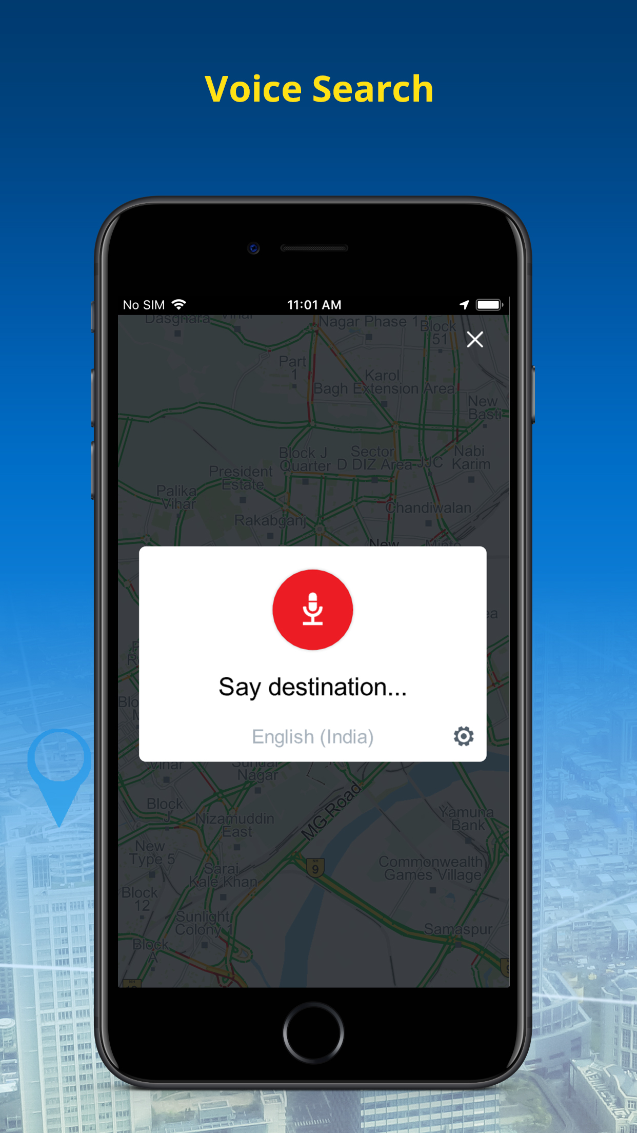
NaviMaps: 3D GPS Navigation, an interactive maps and navigation app with voice direction. Get detailed maps of India, Bangladesh, Bhutan, Nepal & Sri Lanka, powered by MapmyIndia. Save your mobile data as NaviMaps: 3D GPS Navigation doesn't require internet to function. With internet, get Live Traffic feed, Location & Route sharing via SMS, WhatsApp, Email & Facebook.
INSTALL NaviMaps: 3D GPS Navigation today to get access to all Pro-Guidance features for FREE for 7 Days.
Features Include:-
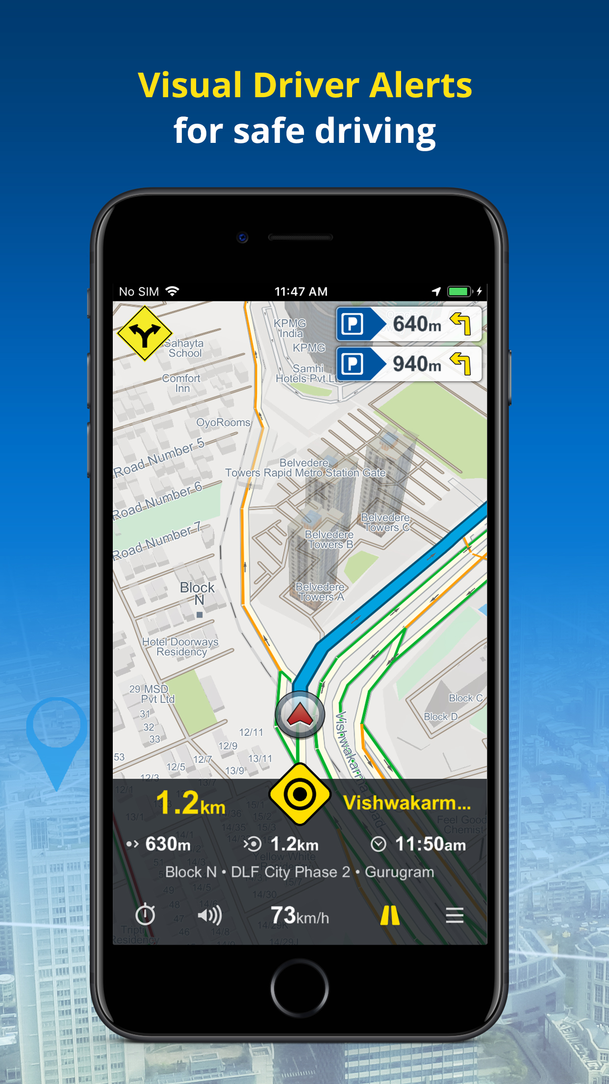
• Junction Views - Visual aid to the driver at road junctions.
• Driver Alerts & Realistic Signposts - Visual driver alerts for better situational awareness.
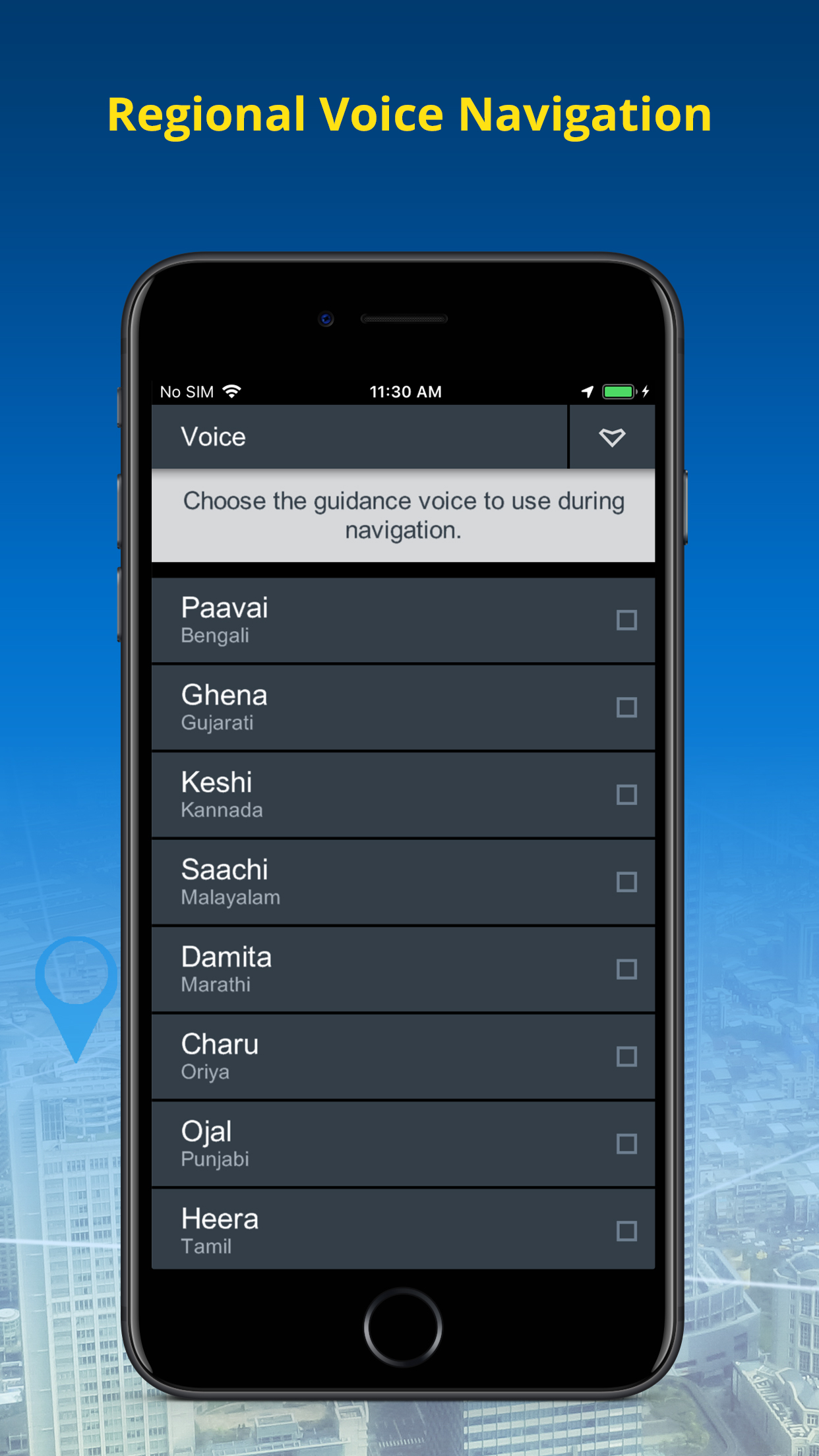
• Live Turn-by-Turn voice guidance in English & 10 regional languages: Hindi, Kannada, Marathi, Punjabi, Bengali, Gujarati, Malayalam, Oriya, Tamil & Telugu*
• Text to Speech - NaviMaps speaks out place names during voice prompts.
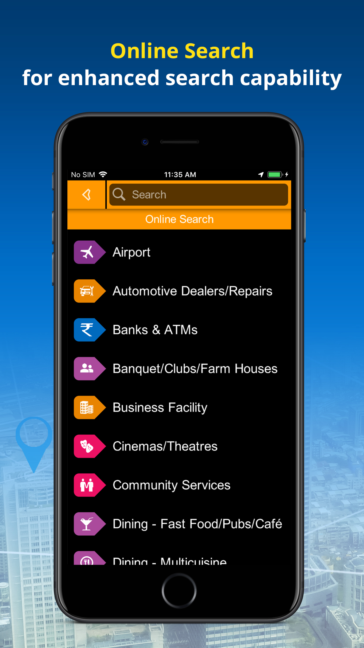
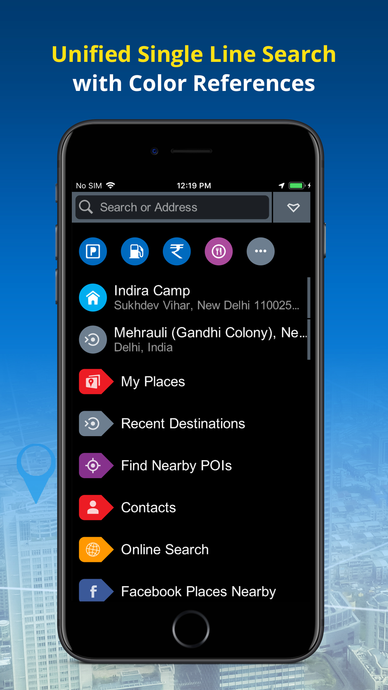
• Unified Search: Search EVERYTHING from one interface with colour coded visual references.
• Auto re-route navigation with voice will re-route you from the deviated course.*
• Varied POI, down to the house no., also locate Petrol Pumps & Parking Places along the route.*
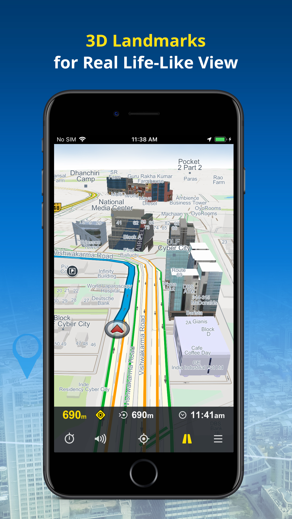
• Detailed map coverage, realistic 3D Landmark, terrain & city models for better recognition*
• FREE lifetime MAP UPDATES*
• NaviMaps: 3D GPS Navigation can be synced with your in-car navigation system, making it into a fully-featured navigation system. NaviMaps supports connectivity with Maruti Suzuki Smartplay Studio™ Infotainment*
• Offline maps, directions, local search and Online search on your device
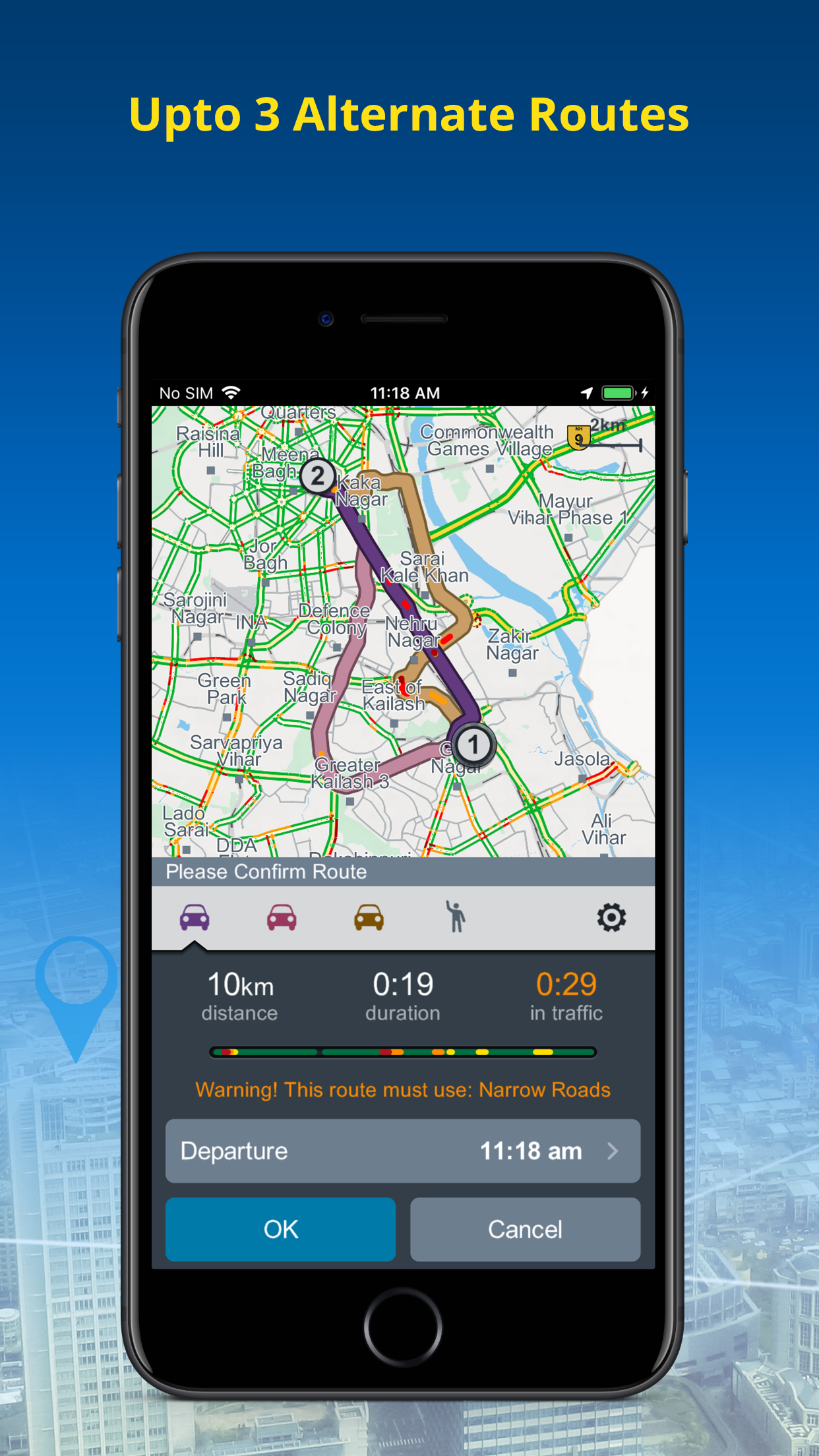
• Get up to 3 alternate driving routes & 1 pedestrian route. The route automatically updates you with Live Traffic (Internet required)
• Location & route sharing through WhatsApp, SMS, Email & Facebook
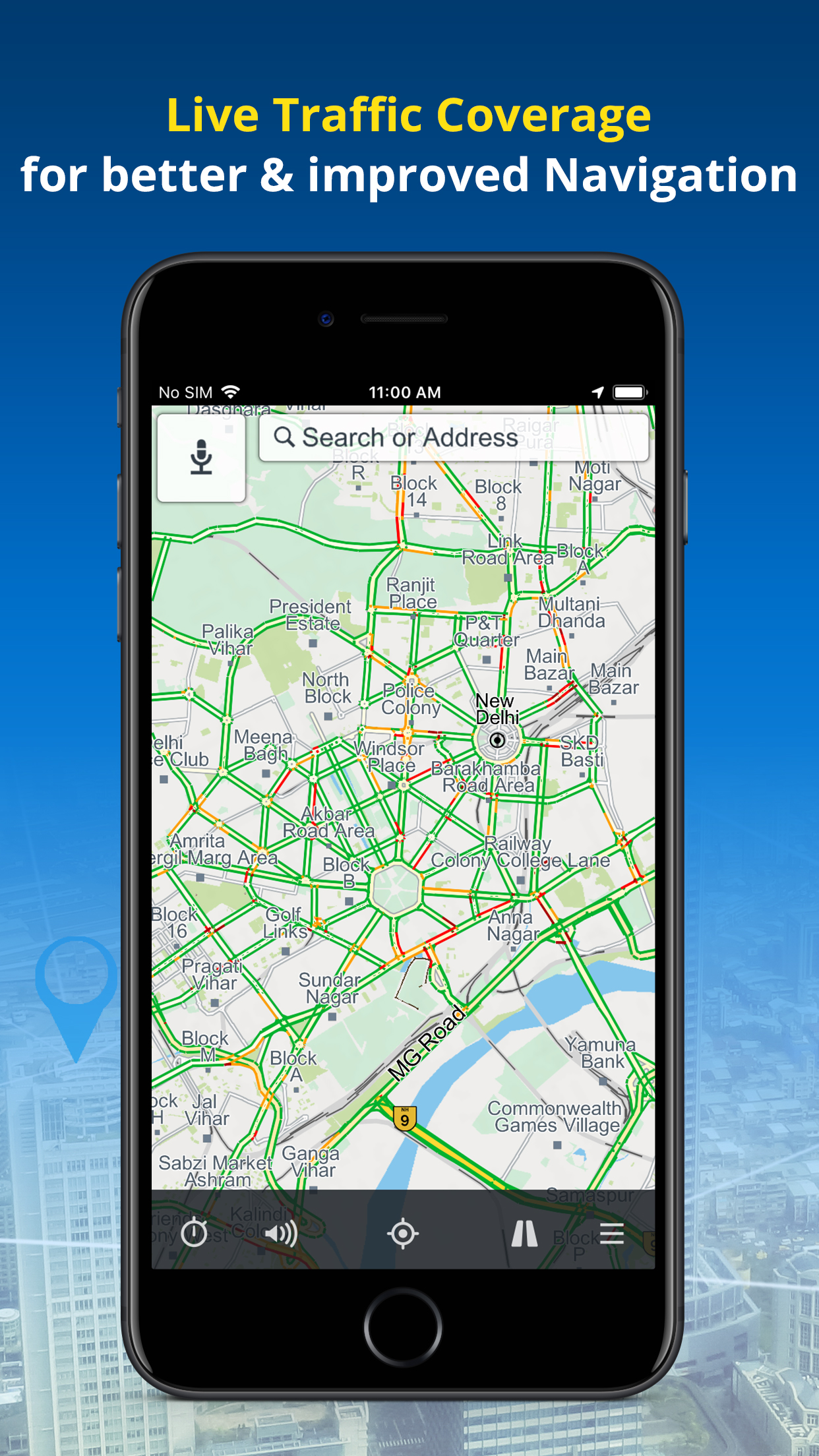
• Via internet, get live traffic & expected delay.
• Multi-Stop routing to plan trips for leisure or business
• Multi-touch map display
• Two-finger swipe down to return to map view from any page or menu
Maps:-
Map of India is split into 32 different states which you can download as per travel plan. Download, remove & re-download maps as often as they like.
• 6.28 Mn+ kms of roads connecting 7532+ towns & 700K+ villages
• 30.45 million+ points of interest across the country
• 6500 3D Landmarks & 2D footprints in 320 cities
• 14.18 million+ house numbers for last-mile navigation in 355 cities
• Lane Guidance in 900+ cities along with national stretches
Sri Lanka:
• 130998+ kms of roads connecting 304 cities at street level with 4100+ towns & villages
• 169500+ Points of Interest
• 94 3D Landmarks & 1980000+ 2D footprints in 269 cities
• Lane Guidance in 5 cities
Nepal:
• 163380+ kms of roads connecting 223 Cities at street level with 7450 towns & villages
• 85500+ Points of Interest
Bangladesh:
• 141224+ kms of roads connecting 265 Cities at street level with 2328 towns & villages
• 110000+ Points of Interest
• 7373966+ 2D footprints
Bhutan:
• 11273+ kms of roads connecting 27 Cities at street level with 138 towns & villages
• 3745+ Points of Interest
ENHANCED LIVE TRAFFIC Coverage for all India.
Install NaviMaps: 3D GPS Navigation today.
Note:
Continued use of ANY GPS application running in the background can significantly drain your phone’s battery. Using a charger while navigating is recommended.
* Requires purchase of Pro-Guidance in-app.
For any app related issues and feedback, please mail us on (navimaps@mapmyindia.com). We would love to hear from you.

Sort by
youtellmewhatname
gangava
Not working in pioneer system
psvvs
App king
isr9494
Best App
iamshajeer
Not working with smartplay studio
memcowala
Excellent
-
Standard100.00%


They are headquartered at New Delhi, India, and have 4 advertising & marketing contacts listed on Kochava. Mapmyindia works with Advertising technology companies such as Chango, Turn, The Trade Desk, AppNexus, Neustar AdAdvisor, Resonate Insights, Dstillery, AOL-Time Warner Online Advertising, BlueKai, Atlas, DemDex, DoubleClick.Net, Google Publisher Tag, Google Ad Partner Services, Google Adsense, Facebook Custom Audiences, Twitter Ads, DoubleClick Bid Manager, Pubmatic, Rubicon Project, Google Remarketing, Criteo, Criteo OneTag, AdRoll, FLoC, Outbrain Pixel, Outbrain, Taboola, Consent Management Platform API v 2.0.


Poor